 vesseltracker.com
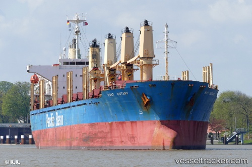
Vessel BELUGA A IMO: 9256353, MMSI: 314684000 Bulk Carrier
Live AIS position:
UTC. Near Kamaterón),
updated 2023-12-29 07:41:49 UTC.
Find the position of the vessel BELUGA A on the map. The latter are known coordinates and path.
marine traffic ship tracker show on live map
The current position of vessel BELUGA A is 37.88911 lat / 23.53288 lng. Updated: 2023-12-29 07:41:49 UTCCurrently sailing under the flag of Barbados
BELUGA A built in 2001 year
Deadweight:
28470 tDetails:
Last coordinates of the vessel:
2023-12-29 07:41:49 UTC, 37.88911, 23.53288, course: 300, speed: 0